
Our programs are key to improving the watershed.

The Watershed Alliance works on a variety of fronts to protect the Upper Grand River. We study the health of the river system, restore areas that fail to meet water quality standards, and identify high quality areas that preserve water quality. It takes a village to protect a watershed (or something like that), so we also encourage community involvement in all of these programs.
River Health Monitoring
Adopt-A-Stream
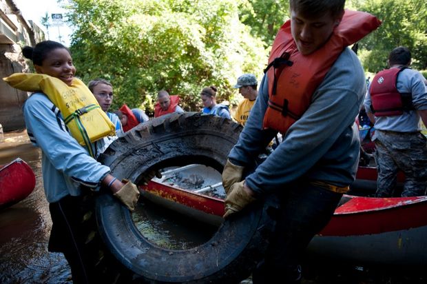
It's not quite the same as "Adopt-A-Highway;" for trash collection on the river we rely on our partner, GREAT, and their annual Grand River Cleanup. Instead, our Adopt-A-Stream volunteers monitor water quality in local streams by collecting "bugs". The technical term is, "macroinvertebrates" (macro meaning large and invertebrates meaning they lack a backbone). It's like a science project for adults - it's not your standard Saturday activity, but it's a ton of fun and something different to talk about around the water cooler at work. Join us in getting out in the woods, wading in a stream (if you choose) and meeting new friends. You'll learn about the ecology of the river and you'll provide the Watershed Alliance with vital information to track trends and identify problem areas in the watershed. The Upper Grand River Adopt-A-Stream Program is jointly run by the Jackson County Conservation District (JCCD) and the Upper Grand River Watershed Alliance (UGRWA). Our Adopt-A-Stream program is also part of a statewide network coordinated by the Michigan Clean Water Corps (MiCorps). Data you collect not only help us locally but become part of a state-wide database.
Three times a year, Adopt-A-Stream volunteer teams visit the river to collect information regarding its physical condition (e.g., surrounding land uses, evidence of erosion or sedimentation, water clarity, etc.) and to collect bugs. Some team members wade in the stream to do the collecting; other Adopters stay on land to sort through the collected mud, sticks, leaves, etc., to pick out the bugs.
Each team generally visits two sites on a Saturday. A separate gathering is held the following week to sort and identify the bugs collected. Please join us. You bring the enthusiasm, we'll provide training, equipment, and an experienced team leader. Please see the information below regarding our next Adopt-A-Stream event:
When:
Where:
Sign Up:
Share with a Friend:
Why Do We Look at Bugs?
A healthy river should support a diverse mix of fish and other aquatic life. Because different species of fish and macroinvertebrates require specific conditions to survive and reproduce, they serve as useful indicators of the conditions in our stream. Like canaries in a coal mine, the presence or absence of species that require cool temperatures and a lot of dissolved oxygen give us insight into issues that need to be addressed and where we need to investigate further. Whereas fish can swim away if a section of river is suddenly impacted by pollution, the bugs cannot. The bugs best represent average conditions in the river. A collection of bugs that has both a diverse assemblage of species and species intolerant of pollution indicates that the river is healthy.
Special Studies
In addition to our volunteer Adopt-A-Stream monitoring program, the Watershed Alliance also conducts special studies to assess water quality, streamside habitat, and other concerns. We are currently involved in monitoring water chemistry and bacteria concentrations a bit outside of our watershed in the headwaters of the adjacent Kalamazoo River.
Working with the Jackson County Drain Commissioner's Office, the Watershed Alliance is describing baseline water quality conditions before a planned Concentrated Animal Feeding Operation (CAFO) of 5,000 hogs begins operation. Baseline monitoring and follow-up studies after hog manure is spread on nearby fields, will allow us to track whether manure and runoff adversely affect local streams. With a number of CAFOs planned for the upper Kalamazoo and Grand River areas, identifying necessary safeguards will help us better protect our waterways.
Watershed & Water Trail Planning
In 2003, communities and nonprofit agencies, from across the watershed, came together and developed a Watershed Management Plan for the Upper Grand River (UGRWMP). That Plan recommended creating an umbrella organization to address water quality and land use issues that cross political boundaries,and led to the creation of the Upper Grand River Watershed Alliance. The Alliance's overarching purpose is to implement action plans and recommendations in the UGRWMP. We also review and revise the plan as our work progresses and we learn more.
The UGRWMP stresses the importance of getting people on the water. It is our opinion that once you experience the Grand River, you'll love it. Once you find you love it, you're more likely to help protect it. As such, the Alliance is working to add or improve 33 canoe and kayak access sites, and camping options, on 90+ miles of lakes and streams in the Upper Grand and link those trails with more than 200 miles of additional paddle trails in the Middle and Lower Grand River.
Natural Shorelines
Shorelines on lakes are also an important part of preserving water quality in the Upper Grand River. Native plants can help stop erosion and create habitat for wildlife.
Green Infrastructure & Stormwater Management
Unfortunately portions of the Upper Grand River and its largest tributary, the Portage River, fail to meet Michigan water quality standards. Concentrations of Escherichia coli (E. coli) bacteria in the river are too high in both the Grand River and Albrow Creek, exceeding limits for swimming and full-body contact. Dissolved oxygen (DO) concentrations are too low. Fish and "bug" populations are also poorer than they should be.
As such, municipalities in the Jackson urban area (Jackson County, the City of Jackson, and Blackman and Leoni Townships) are required to have Municipal Separate Storm Sewer System (MS4) permits from the State of Michigan and must ensure their storm sewers carry only storm water, provide public education about storm water and water quality, and work to improve storm water treatment. Representatives of these communities and the Watershed Alliance make up Jackson Urban Area Phase II Stormwater Committee.
TMDL is short for Total Maximum Daily Load. That's a long way of saying a target for reducing pollution. TMDLs are calculated and required by the state of Michigan for area lakes, streams, or rivers that fail to meet water quality standards.
This is the case for four (4) TMDLs have been developed for portions of the Upper Grand River. so a biota TMDL is in place for part of the Upper Grand mainstem and parts of the Portage River.
Soil eroded from the river's banks, washed off our lawns, streets, parking lots, and farm fields is the chief reason for both poor habitat and low dissolved oxygen in the river. Communities, agencies, and individuals within the watershed are searching for ways to reduce this sediment load. This includes sweeping streets, planting buffer strips between cropland and the river, using no-till farming methods, stabilizing eroding stream banks, enacting new ordinances, and storing and reducing runoff.
One of the principal sources of pollution to the Upper Grand River is overland runoff as rain and snowmelt carry fertilizers, metals, soil, bacteria, and other materials to the river.
River Restoration
Restoring natural conditions to a river can improve the health of the river as well as reduce erosion, help with flood management and improve water quality. Restoration can improve habitat for fish, wildlife, and improve recreational experiences on the river.
The Upper Grand River Watershed Alliance has supported restoration with several projects:
Recently, the Jackson County Drain Commissioner contracted to have log-jams cleared on the Portage River. This helped reduce flooding and erosion problems.
The 2006 to 2008 Upper Grand River Implementation Project where partner organizations focused efforts on Best Management Practices (BMPs) in priority areas of the Upper Grand River. Some of these included a 340-acre wetland restoration involving pushouts and serpentine channels. Agrichemical containment facilities, livestock use exclusion, and roof runoff and underground management practices have also been implemented in the priority area.
In 2007, JCCD and NRCS began implementing and/or facilitating landowner implementation of conservation practices for medium, high and very high areas of the Portage River.
With a 2009 319 grant, the JCCD implemented an agricultural demonstration project in 250 feet shoreline stabilization at Vandercook Lake County Park and a biorention basin (rain garden) at Russell Park.
In 2013, UGRWA worked with the Jackson County Drain Commissioner’s office and local farmers to identify lands where levees may be breached and wetlands established to reduce flooding along the Jackson County’s portion of the Portage River.
In 2017 Watershed Alliance staff worked with the Jackson County Parks Department to oversee grant implementation and construction to restore the historic flow patterns between North and South Lime Lakes and Third Lake to help restore the Lime Lake fen.
Natural Areas Assessment & Protection
Beginning in 2006, UGRWA developed scientifically defensible methods to inventory and prioritize undeveloped parcels for preservation. This was developed and applied in Waterloo, Henrietta, and Leoni Townships. Methodology was improved and applied to priority subbasins of the Portage River, Grass Lake Drain, and Sandstone Creek. These projects were funded by 319 grants to the JCCD and the Legacy Land Conservancy.
In 2017 Watershed Alliance staff worked with the Jackson County Parks Department to oversee grant implementation and construction to restore the historic flow patterns between North and South Lime Lakes and Third Lake to help restore the Lime Lake fen.
Public Education
Educating yourself and others about the watershed is an important way to help. Here are some past accomplishments and some links to learn about the watershed:
The MS-4 communities, the Jackson County Conservation District (JCCD) and UGRWA started and has continued a citizen science Adopt-A-Stream monitoring program to familiarize watershed residents and provide education on impacts to stream fauna.
The MS-4 communities, JCCD and UGRWA continually promote public education regarding watershed stewardship at their offices, on their web sites. Come visit our booths at the Jackson Earth Day Celebrations and the Jackson County Fair!
JCCD works annually with the MS-4 communities for disposal or drop-off of household or hazardous waste.
With a 2009 319 grant, the JCCD implemented an agricultural demonstration project in 250 feet shoreline stabilization at Vandercook Lake County Park and a biorention basin (rain garden) at Russell Park.
Past public education programs with UGRWA included the 2006 to 2008 319 funded Upper Grand River Implementation Project. In 2011, the JCCD hosted a best management practice Watershed Tour with 36 participants. The JCCD and Natural Resources Conservation Service (NRCS) continue to promote agricultural best management practices (BMPs) among farmers.
In 2011, UGRWA trained 11 volunteers to identify and locate illicit discharges. One discharge was reported during a GREAT annual river clean-up.
The Grand River Expedition, a 14-day, 225 mile paddling trip promoted education and recreation beginning at the Upper Grand River. This was following a 2000 expedition. Due to the COVID-19 pandemic, the 2020 expedition was cancelled. Instead, paddlers were encouraged to travel with self-guided tours along parts of the river and record their experiences. Stay tuned! There may be another GREx coming before 2030!
In 2018, JCCD and UGRWA teamed with The JCCD Jackson-Lenawee-Washtenaw Cooperative Invasive Species Management Area (JLW CISMA) to educate people about invasive species and ways to eliminate or reduce their spread.
What other things can be done to help educate yourself and others? Stay tuned for links!
Fighting Invasive Species
Non-native species that cause harm to the environment are called invasive species. They out-compete native species and often do not have any natural predators.
One of our partners is the Jackson Lenawee and Washtenaw County Cooperative Invasive Species Management Areas (JLCISMA). JLCISMA educates and helps prevent, detect, eradicate and control invasive species in the Upper Grand River watershed.